
Counting the waves…
Counting the waves…
A refined fusion of water purity, environmental stability, and communal vibrancy for Playa Los Naranjos.
View MethodologyAnalyzed via live sensors and environmental data.
Wave height, wind, and atmospheric stability.
Live footfall and crowd balance metrics.
Community reviews and curated sentiment.
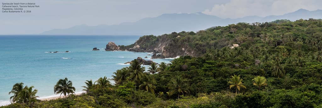
“Where the Don Diego River spills into the Caribbean, Playa Los Naranjos offers a dramatic confluence of fresh and saltwater, creating powerful surf breaks against a backdrop of lush tropical forest and golden sand.”
Limited recent visitor reports — live OBI telemetry is your best guide for current conditions.
Playa Los Naranjos holds an iconic status among Colombia's surf community and nature lovers alike. Situated just east of the famed Tayrona National Park, this beach is defined by the impressive sight of the Don Diego River meeting the vast Caribbean Sea. This unique geographical feature creates dynamic sandbars and powerful, consistent waves that draw surfers from around the globe.
The scenery here is nothing short of spectacular. Imagine broad stretches of golden sand fringed by dense, emerald-green jungle, with the distant peaks of the Sierra Nevada de Santa Marta often visible on clear days. The air is a heady mix of salt spray and the earthy scent of the river, a constant reminder of the vibrant ecosystems converging at this point.
Powerful, consistent waves
Golden sand relaxation
Jungle, river, ocean views
Prime Visitation
Best Weather|Less Crowds
Where it is
Playa Los Naranjos
Los Naranjos, Magdalena, Colombia
11.302700°, -73.883500°
Weather
Loading…
Swell
—
Temp
Warm · Restorative
UV Index
Moderate
Wind
—
Tidal State
Last known
Max Sunlight
—
Ideal Shade
—
Jan - Dec (Peak)
May - Nov (Off-season)
Best Weather|Less Crowds
Select a category to load nearby places.
Unlock restaurants, luxury stays and curated maritime experiences within 2km
Playa Los Naranjos is primarily known as a surf beach with strong currents, especially near the river mouth. While incredibly scenic, it is generally not recommended for casual swimming, particularly for families with young children or inexperienced swimmers. The powerful waves and undertows can be dangerous. It's best enjoyed for its views, surfing, and beach walks, with caution exercised if entering the water.
The best time to visit Playa Los Naranjos for optimal weather and to avoid the largest crowds is typically during the dry season, which runs from December to April. During these months, you'll experience more sunshine and less rain, making for pleasant beach days. Visiting outside of major holiday periods will also help ensure a more tranquil experience, allowing you to fully appreciate the wild Caribbean scenery.
Playa Los Naranjos is conveniently located just east of Tayrona National Park. From Santa Marta, you can take a bus or colectivo heading towards Palomino or Riohacha. Ask the driver to drop you off at the entrance to Los Naranjos. The journey is relatively short, usually less than an hour. From the main road, it's typically a short walk to reach the beach, often through a picturesque path.
Playa Los Naranjos offers a range of lodging options, from eco-lodges and boutique hotels to guesthouses, many with stunning views of the ocean and river. Food options include restaurants within the accommodations, often serving fresh seafood and local dishes, as well as a few independent eateries. While not as extensive as larger towns, there are enough choices to ensure a comfortable stay, often with a focus on natural settings.
Playa Los Naranjos is iconic due to its dramatic river-mouth surf break and its stunning wild Caribbean scenery, set against the backdrop of the Sierra Nevada mountains. Its location just outside Tayrona National Park adds to its allure, offering a similar natural beauty but with a more focused surf culture. The powerful waves, lush surroundings, and picturesque river meeting the sea create an unforgettable and highly Instagrammable landscape.