
Counting the waves…
Counting the waves…
A refined fusion of water purity, environmental stability, and communal vibrancy for Pouto Beach.
View MethodologyAnalyzed via live sensors and environmental data.
Wave height, wind, and atmospheric stability.
Live footfall and crowd balance metrics.
Community reviews and curated sentiment.
“You stand at the edge of two waters—the harbour's muddy estuary to your left, the Tasman's roar somewhere beyond the dune ridge to your right. Between them, a narrow spine of sand and scrub stretches north for…”
Limited recent visitor reports — live OBI telemetry is your best guide for current conditions.
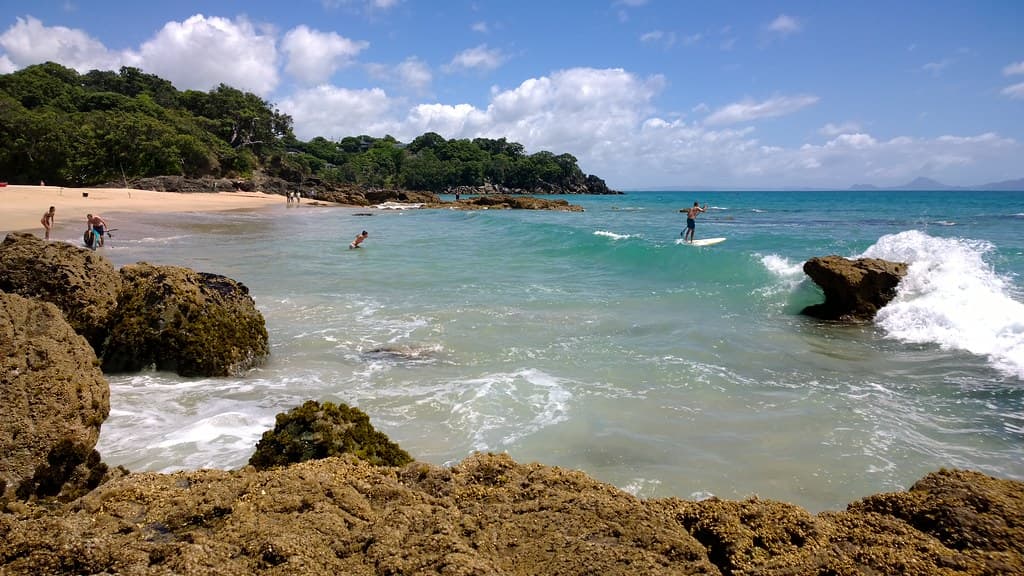
Pouto occupies a sliver of geography that feels like the end of something. The beach faces east across the Kaipara Harbour, New Zealand's largest, its opposite shore a hazy line of pine and pasture. Behind you, towering dunes block the western horizon, but you can hear the Tasman pounding the outer coast, a low thunder that never quite stops. The sand here is firm and grey, littered with driftwood the size of telephone poles and the scattered detritus of storms—buoys, nets, bleached crab shells.
The settlement of Pouto is a handful of baches and a lighthouse keeper's cottage, clustered where the peninsula narrows. Walk north and you'll trace a shoreline that curves gently, the harbour spreading wide and shallow at low tide. Wading birds work the mudflats—godwits, herons, stilts—while gulls wheel overhead. The dunes inland rise in soft, grassy slopes, their seaward faces carved by wind into sharp ridges. In places, the bones of old wrecks poke through the sand, remnants of ships that misjudged the harbour entrance.
Long-tail boats moored in clear water
Harbour and ocean both visible
Storm-tossed timber and wrecks
Godwits and herons at ebb
Prime Visitation
Less Crowds
Where it is
Pouto Beach
Pouto, Northland, New Zealand
-36.350100°, 174.176300°
Weather
Loading…
Swell
—
Temp
Warm · Restorative
UV Index
Moderate
Wind
—
Tidal State
Last known
Max Sunlight
—
Ideal Shade
—
Jan - Dec (Peak)
Mar - Nov (Off-season)
Historical data suggests peak visibility and stable sea temperatures occur during the prime visitation window.
Select a category to load nearby places.
Unlock restaurants, luxury stays and curated maritime experiences within 2km
Pouto Beach requires caution as it sits at the entrance to Kaipara Harbour, where ocean meets harbour currents. Strong currents, shifting sandbars, and unpredictable conditions make swimming potentially dangerous, especially near the harbour entrance. The beach is unpatrolled and remote, so help is not readily available. Many visitors enjoy the beach for walking, fishing, and scenery rather than swimming. If you do enter the water, stay in shallow areas, never swim alone, avoid the harbour entrance area, and be extremely vigilant with children. The wild, exposed nature demands respect.
Pouto Beach is best visited during settled weather periods when you can safely explore and appreciate its remote beauty. Summer offers the most pleasant conditions, though this wild coast can be magnificent year-round for landscape photography and solitude. The beach is less about swimming and more about experiencing dramatic coastal scenery, so shoulder seasons and even winter can be rewarding for hardy visitors. Sunset is particularly spectacular due to the westward orientation. Avoid rough weather when access roads may become difficult and conditions dangerous.
Pouto Beach is remote and requires careful navigation. From Dargaville, head toward Pouto Peninsula via Pouto Road. The route involves both sealed and gravel roads, with the final sections quite rough. A vehicle with good clearance is recommended, and 4WD may be necessary in wet conditions. The journey takes about 45 minutes from Dargaville. Roads can be challenging, so allow plenty of time and check conditions locally before attempting. Fuel up and bring supplies as there are no services en route. The isolation is part of the appeal but requires preparation.
Pouto Beach has virtually no facilities—this is a truly remote destination. There are no shops, cafes, or services at the beach itself. Bring all food, water, and supplies from Dargaville, the nearest town with full services. Accommodation is limited to a few holiday homes and the small Pouto Point community. Most visitors are self-sufficient day-trippers or have pre-arranged private accommodation. Camping may be possible in designated areas, but confirm locally. The lack of development preserves the wild, untouched character that makes Pouto special.
Pouto Beach offers raw, dramatic coastal wilderness at the northern head of Kaipara Harbour—New Zealand's largest harbour. The massive sand dunes, expansive views, and sense of isolation create a landscape of remarkable scale and beauty. Historical significance includes early Māori and European settlement sites. The meeting of harbour and ocean produces dynamic, ever-changing conditions. It's ideal for adventurous visitors seeking solitude, big skies, spectacular sunsets, and an untouched coastal experience far from crowds. The journey to this remote location becomes part of the adventure itself.
Photos