
Counting the waves…
Counting the waves…
A refined fusion of water purity, environmental stability, and communal vibrancy for Zubarah Fort Coastline.
View MethodologyAnalyzed via live sensors and environmental data.
Wave height, wind, and atmospheric stability.
Live footfall and crowd balance metrics.
Community reviews and curated sentiment.
“Walk the sands where pearl divers once launched their dhows, with the imposing silhouette of Zubarah Fort standing sentinel against the horizon. This coastal stretch offers more than just a beach; it's a living museum,…”
Limited recent visitor reports — live OBI telemetry is your best guide for current conditions.
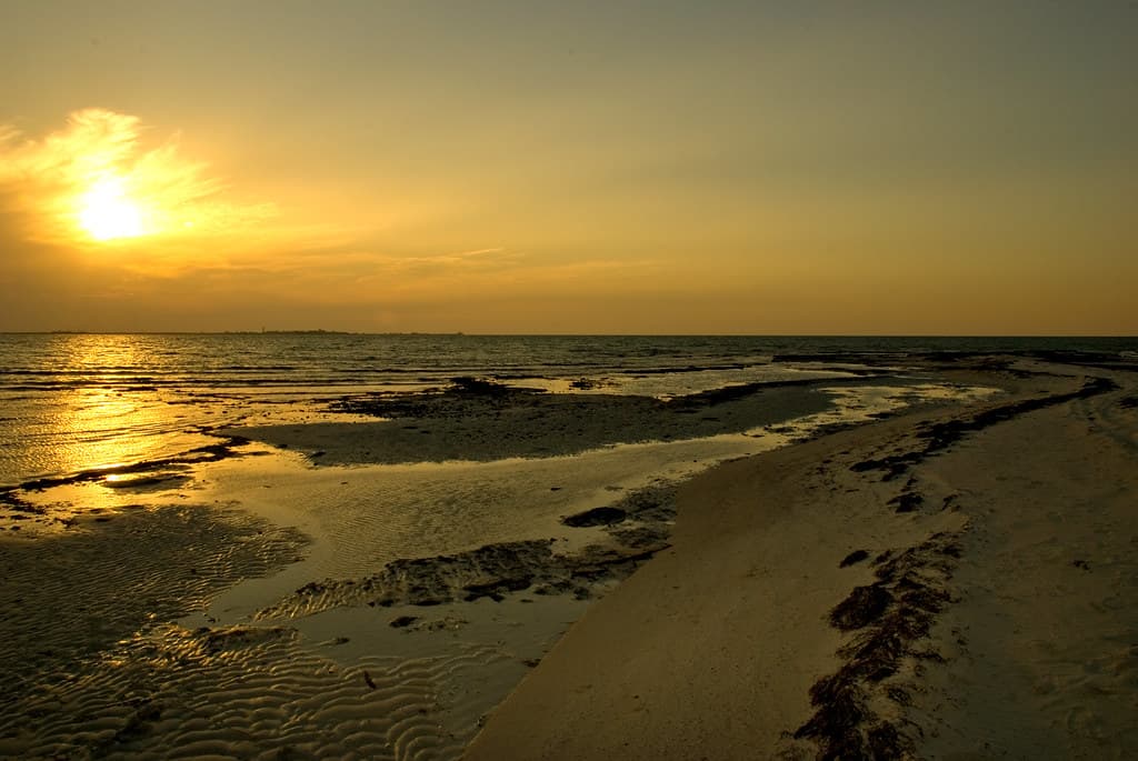
The Zubarah Fort Coastline isn't merely a strip of sand; it's a historical tableau where the past breathes alongside the present. With the UNESCO-listed Zubarah Fort dominating the landscape, you're walking on ground steeped in centuries of trade and pearl diving history. The fine, pale sand stretches gently into the Gulf, its surface often dotted with fragments of ancient pottery, a tangible link to the vibrant port city that once thrived here.
As you wander, the fort's robust walls, built from coral and limestone, offer a dramatic backdrop to the endless expanse of water. The air carries a faint salinity, a reminder of the Gulf's enduring presence and its role in shaping Qatar's heritage. This is a place where the wind seems to carry stories of merchants, sailors, and the arduous lives of pearl divers.
Crashing wave at sunset on the shoreline
Capture historic landmark
Explore archaeological site
Gentle Gulf waters
Prime Visitation
Best Weather
Where it is
Zubarah Fort Coastline
Al Zubarah, Al Shamal Municipality, Qatar
26.026500°, 51.023500°
Weather
Loading…
Swell
—
Temp
Warm · Restorative
UV Index
Moderate
Wind
—
Tidal State
Last known
Max Sunlight
—
Ideal Shade
—
May - Sep (Peak)
Jan - Dec (Off-season)
Historical data suggests peak visibility and stable sea temperatures occur during the prime visitation window.
Select a category to load nearby places.
Unlock restaurants, luxury stays and curated maritime experiences within 2km
The Zubarah Fort Coastline offers a natural, undeveloped experience. While swimming is generally possible, there are no lifeguards or designated swimming areas. Visitors should exercise caution, be aware of tides and currents, and bring all necessary supplies as facilities are minimal to non-existent. It's best suited for scenic walks rather than extensive swimming.
The best time to visit the Zubarah Fort Coastline is during Qatar's cooler months, typically from October to April. During this period, the weather is most pleasant for exploring the archaeological site and enjoying the coastal views without the intense summer heat. Early mornings or late afternoons are ideal for photography and experiencing a beautiful sunset.
The Zubarah Fort Coastline is located in Al Zubarah, in the northern part of Qatar. It's best accessed by car, as public transport options are limited. From Doha, it's approximately a 1.5 to 2-hour drive. There is typically ample informal parking available near the fort, from which you can access the coastline. Follow signs for Al Zubarah Fort.
The area around Zubarah Fort Coastline is largely undeveloped, focusing on preserving the historical site. Consequently, there are no immediate food vendors, restaurants, or hotels directly on the coastline. Visitors should plan to bring their own refreshments and snacks. For lodging and more extensive dining options, it's advisable to stay in Doha or other larger towns.
The Zubarah Fort Coastline is unique for its direct proximity to the UNESCO World Heritage site of Al Zubarah Fort and its archaeological remains. It offers a rare opportunity to combine historical exploration with natural coastal beauty. The undeveloped nature of the coastline provides a serene backdrop, allowing visitors to imagine the historical significance of the area while enjoying views of the Arabian Gulf.
Photos