
Counting the waves…
Counting the waves…
A refined fusion of water purity, environmental stability, and communal vibrancy for Lae O Kealaikahiki Cove.
View MethodologyAnalyzed via live sensors and environmental data.
Wave height, wind, and atmospheric stability.
Live footfall and crowd balance metrics.
Community reviews and curated sentiment.
“You'll find Lae O Kealaikahiki Cove pressed into the southwestern shore of Kaho'olawe, an island sealed to casual visitors yet alive with the footprints of ancient navigators. Salt spray mists the rust-red cliffs while…”
Limited recent visitor reports — live OBI telemetry is your best guide for current conditions.
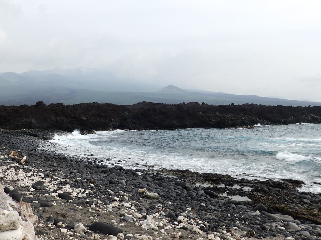
The cove curves into Kaho'olawe's arid coastline like a thumbnail pressed into warm clay, its cobalt water pooling against shelves of weathered a'ā lava. Stepping onto the beach—when restoration volunteers or cultural practitioners land here—you inhale air sharpened by kiawe and the faint metallic tang of volcanic rock baking under relentless sun. The horizon spreads unbroken toward Tahiti, tracing the path Hawaiian wayfinders once followed by star and swell.
This is not a beach for impulse visits. Kaho'olawe remains under the stewardship of the Kaho'olawe Island Reserve Commission, accessible only through authorized programs that blend ecological restoration with cultural education. The shoreline itself bears the scars of decades as a military bombing range, yet native 'ilima and pōhinahina are slowly reclaiming the slopes above the waterline. Anchialine pools dot the basalt, their brackish water home to 'ōpae'ula shrimp that glow crimson in afternoon light.
Credit: PexelsTrace Navigator Trails
Follow paths used by wayfinders
Photograph native plant regeneration zones
Study star lines at dusk
Where it is
Lae O Kealaikahiki Cove
Kaho?olawe, Hawaii, USA
20.549800°, -156.480500°
Weather
Loading…
Swell
—
Temp
Warm · Restorative
UV Index
Moderate
Wind
—
Tidal State
Last known
Max Sunlight
—
Ideal Shade
—
Jan - Dec (Peak)
May - Nov (Off-season)
Historical data suggests peak visibility and stable sea temperatures occur during the prime visitation window.
Select a category to load nearby places.
Unlock restaurants, luxury stays and curated maritime experiences within 2km
Swimming conditions cannot be assessed as public access to Kaho'olawe is prohibited. The island has been restricted since 1941, first as a military training area and now as a protected cultural reserve. The waters surrounding Kaho'olawe can be treacherous with strong currents and channels. Only authorized personnel involved in restoration projects or Native Hawaiian cultural practitioners with special permits may visit the island, and recreational activities like swimming are not permitted during these supervised visits.
Lae O Kealaikahiki Cove is not accessible to the general public year-round. Kaho'olawe is a restricted island under the stewardship of the Kaho'olawe Island Reserve Commission. Access is limited to cultural practitioners, volunteers participating in restoration programs, and authorized research personnel. The island experiences dry conditions with minimal rainfall throughout the year. If you're interested in Kaho'olawe's history and culture, consider visiting museums and cultural centers on neighboring islands that share information about this sacred place.
There is no public access to Lae O Kealaikahiki Cove or anywhere on Kaho'olawe. The entire island is closed to unauthorized visitors and can only be reached by boat with special permission from the Kaho'olawe Island Reserve Commission. No commercial tours operate to the island. Access is strictly limited to approved cultural access trips, volunteer restoration workdays, and authorized educational programs. These supervised visits require advance applications and clearance. The island has no developed infrastructure, parking facilities, or tourist amenities.
Kaho'olawe has no restaurants, facilities, or accommodations of any kind. The uninhabited island has no infrastructure, electricity, running water, or commercial services. It remains undeveloped as part of its designation as a cultural reserve. The closest amenities are on Maui, approximately seven miles across the 'Alalākeiki Channel. If interested in learning about Kaho'olawe, you can view the island from various points on Maui's southern coast, particularly from Makena, while staying in nearby areas like Wailea or Kihei.
Lae O Kealaikahiki means "the point of the road to Tahiti," reflecting the cove's importance as a departure point for ancient Polynesian navigators. Kaho'olawe holds deep spiritual significance in Native Hawaiian culture and contains numerous archaeological sites including fishing shrines, habitation areas, and religious heiau. The island was used for military bombing practice from 1941-1990, causing extensive damage. Since 1994, it has been designated as a cultural reserve dedicated to restoration and Native Hawaiian practices, symbolizing cultural revival and environmental stewardship throughout Hawaii.
Photos