Counting the waves…
Counting the waves…
A refined fusion of water purity, environmental stability, and communal vibrancy for Crisp Point Beach.
View MethodologyAnalyzed via live sensors and environmental data.
Wave height, wind, and atmospheric stability.
Live footfall and crowd balance metrics.
Community reviews and curated sentiment.
“You'll earn this one: nineteen miles of bone-rattling gravel through pine barrens, then the wide arc of Lake Superior unfurls beneath a 1904 lighthouse. Wind scrapes across blonde sand. Driftwood lies bleached like…”
Limited recent visitor reports — live OBI telemetry is your best guide for current conditions.
The final stretch of County Road 412 punishes your suspension, but Crisp Point Beach rewards every jolt. This is Lake Superior's shipwreck coast, where freighters foundered in nor'easters and the nearest help was fifty miles through swamp. The lighthouse still stands—a white tower against infinite blue—automated now, its keepers long gone. You park in sand-swept gravel and walk toward the waterline, where waves hiss over stones smoothed to the size of goose eggs.
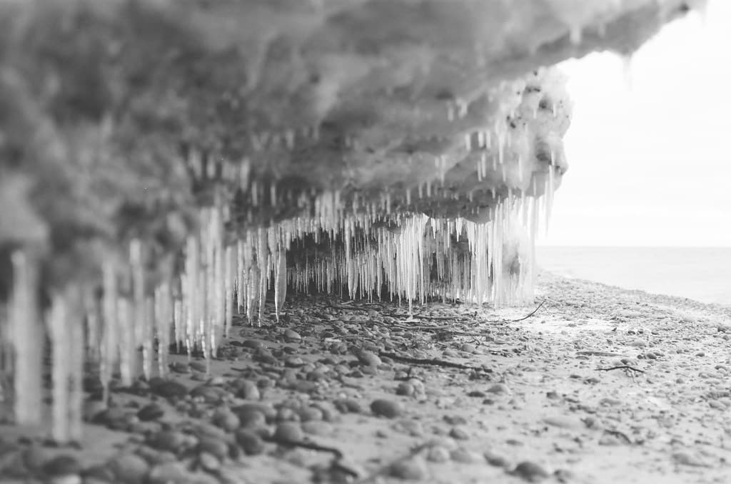
The beach curves northeast for miles, hemmed by low dunes and jack pine. In summer, the lake breeze keeps mosquitoes at bay; in autumn, the birch forest behind you burns yellow against slate water. Winter brings ice shoves—glittering ridges of fractured plates stacked fifteen feet high. You'll see maybe three other souls here, even in July. They're photographing the lighthouse or beachcombing for agates, moving slowly, speaking in low voices as if the quiet were something you could break.
 Credit: Unsplash
brown grass field near body of water during daytime
 Credit: Unsplash
a log on a beach
Golden hour against driftwood piles
Superior's waves polish striped stones
Bleached logs form natural benches
Where it is
Crisp Point Beach
Paradise, Michigan, USA
46.745600°, -85.263100°
Weather
Loading…
Swell
—
Temp
Warm · Restorative
UV Index
Moderate
Wind
—
Tidal State
Last known
Max Sunlight
—
Ideal Shade
—
May - Sep (Peak)
Jan - Dec (Off-season)
Historical data suggests peak visibility and stable sea temperatures occur during the prime visitation window.
Select a category to load nearby places.
Unlock restaurants, luxury stays and curated maritime experiences within 2km
Swimming at Crisp Point Beach is generally not recommended due to Lake Superior's unpredictable conditions. The water remains extremely cold year-round (typically 40-55°F even in summer), and strong currents, sudden drop-offs, and undertows are common. There are no lifeguards on duty. The beach is better suited for wading, beachcombing, and photography. If you do enter the water, stay close to shore, never swim alone, and be aware that hypothermia can set in quickly even for strong swimmers.
Late spring through early fall (May-October) offers the most accessible conditions, with July and August providing the warmest temperatures. However, each season offers unique appeal: summer brings wildflowers and comfortable hiking weather, fall showcases stunning foliage, and winter transforms the lighthouse into a dramatic ice-covered landmark. Road conditions are most reliable May-October. Weather can change rapidly regardless of season, so bring layers. The remote location means fewer crowds year-round, making it ideal for solitude seekers anytime conditions permit access.
Crisp Point Beach requires driving approximately 18 miles on County Road 412, a rough, sandy two-track road from M-123 near Newberry. High-clearance vehicles are strongly recommended; 4WD is often necessary, especially after rain. The journey takes 45-60 minutes one-way. Free parking is available in a small cleared area near the lighthouse. Cell phone service is non-existent. Fill up with gas beforehand, bring a spare tire, and inform someone of your plans. Winter access may be impossible without snowmobiles or significant off-road capability.
Crisp Point Beach has no amenities whatsoever—no restrooms, no food vendors, no lodging, and no running water. This is a truly remote destination. Visitors must bring all supplies, including food, water, and emergency provisions. The nearest services are in Paradise (about 35 miles) or Newberry (approximately 40 miles), where you'll find restaurants, gas stations, grocery stores, and various lodging options including motels and campgrounds. Pack out all trash. Consider bringing a portable toilet for longer visits, as facilities are non-existent.
The Crisp Point Lighthouse is occasionally open for climbing during summer months, typically managed by volunteer caretakers from the Crisp Point Light Historical Society. Access to the tower isn't guaranteed and depends on volunteer availability and weather conditions. When open, visitors can climb the tower for spectacular Lake Superior views. Even when closed, the exterior and surrounding grounds are accessible for photography and exploration. The lighthouse has been restored through preservation efforts, and donations supporting ongoing maintenance are welcomed. Check ahead if tower access is essential to your visit.
Photos