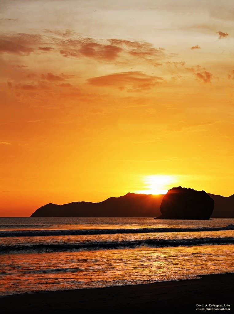
Counting the waves…
Counting the waves…
A refined fusion of water purity, environmental stability, and communal vibrancy for Playa Colorada Santa Rosa.
View MethodologyAnalyzed via live sensors and environmental data.
Wave height, wind, and atmospheric stability.
Live footfall and crowd balance metrics.
Community reviews and curated sentiment.
“The stones here are the color of dried blood, stained by iron oxide and sculpted by centuries of surf. Most visitors to Santa Rosa never see Colorada—it requires a boat or serious bushwhacking—which is why it feels like…”
Limited recent visitor reports — live OBI telemetry is your best guide for current conditions.
Playa Colorada doesn't appear on tourist maps, and that's not an oversight—it's a function of effort. Reaching this stony pocket on the Santa Elena coast means arranging boat transport from a fishing village or navigating an unmarked route through thorn scrub that tears at your clothes and tests your commitment. Your reward is a beach that looks like Mars: ruddy boulders, rust-streaked cliffs, tide pools the color of old pennies.
The rocks are volcanic, oxidized over millennia into shades of sienna, umber, and burnt orange. Waves polish them smooth in some places and carve them into sharp shelves in others. At low tide, you can walk among formations that resemble sculpture—arches, pedestals, slots just wide enough to squeeze through. Hermit crabs scuttle across surfaces that radiate stored heat. The water itself shifts from brown to turquoise depending on sediment stirred by the swell.
 Credit: Unsplash
a blue and yellow sign that says santa monica yacht harbor sport fishing boat cafe
 Credit: Unsplash
A paved promenade with trees and people beside a beach and apartment buildings
Rust hues and wave-carved forms
Arches and tidal sculptures
Crabs and oxidized shelves
Prime Visitation
Less Crowds
Where it is
Playa Colorada Santa Rosa
Santa Rosa National Park, Guanacaste, Costa Rica
10.827000°, -85.721000°
Weather
Loading…
Swell
—
Temp
Warm · Restorative
UV Index
Moderate
Wind
—
Tidal State
Last known
Max Sunlight
—
Ideal Shade
—
Jan - Dec (Peak)
May - Nov (Off-season)
Historical data suggests peak visibility and stable sea temperatures occur during the prime visitation window.
Select a category to load nearby places.
Unlock restaurants, luxury stays and curated maritime experiences within 2km
Swimming at Playa Colorada Santa Rosa is not recommended due to its rocky terrain and exposed location. The beach features colored rock formations rather than traditional sandy swimming areas. Strong Pacific currents, waves, and lack of lifeguards or emergency services make water activities risky. The primary appeal is scenic beauty and wildlife observation rather than swimming or water sports. Rocky surfaces can be slippery and sharp, requiring sturdy footwear. The remote location within Santa Rosa National Park means no immediate help if problems arise. Visitors should appreciate this beach for its geological and natural features while avoiding ocean entry. Staying on shore is the safest approach to enjoying this unique coastal area.
Visit Playa Colorada Santa Rosa during the dry season from December through April for best access and comfortable conditions. During these months, roads to Santa Rosa National Park are more reliably passable and weather is predictably sunny. The intense dry-season heat requires early morning or late afternoon visits for comfort. Rainy season from May through November brings challenging access conditions with muddy roads and potential closures. However, the landscape is greener post-rain with active wildlife. Sea conditions are generally rough year-round given the exposed coastline. Plan visits during weekdays to maximize solitude. Always check park conditions before traveling, as seasonal closures or restrictions may apply to remote coastal areas.
Reaching Playa Colorada Santa Rosa requires boat access or difficult overland travel through Santa Rosa National Park. Boat trips can be arranged from Cuajiniquil or other Santa Elena Peninsula access points. By land, visitors must enter Santa Rosa National Park, navigate rough interior roads with four-wheel drive vehicles, then hike to the coast. The route demands good physical fitness, navigation skills, and proper preparation. Park entrance fees apply, and some areas require ranger permission. This beach is among the more challenging coastal destinations in the region, often overlooked even on detailed maps. Local guides with area knowledge are highly recommended. Expect limited or no cell service throughout the journey.
Playa Colorada Santa Rosa has absolutely no facilities, requiring complete self-sufficiency. Visitors must bring all food, water, and supplies. The nearest minimal services are in Cuajiniquil, a small fishing community with very limited options. Substantial lodging and dining are available in La Cruz or Liberia, both requiring considerable travel time. Santa Rosa National Park offers basic designated camping areas, though not at this specific beach. Some experienced adventurers camp with proper permits and wilderness preparation. Day visits require packing everything needed including substantial water for the hot, exposed environment. This is a true backcountry experience demanding thorough preparation, not a casual beach outing with convenient amenities.
Playa Colorada Santa Rosa is distinguished by its colored rock formations creating unusual coastal scenery rarely found on typical sandy beaches. Located within Santa Rosa National Park, it enjoys protected status and pristine wilderness character with virtually no development or human impact. The beach remains genuinely remote and overlooked by standard tourism, even missing from many mapping databases. This geological uniqueness combines with the dry tropical forest ecosystem creating distinctive coastal landscapes. The difficulty of access ensures exceptional solitude and authentic wilderness experience. For geology enthusiasts, photographers, and adventurers seeking undiscovered places, Playa Colorada offers rewards unavailable at accessible beaches. It represents Costa Rica's wild, unmodified coastline before tourism development.
Photos