Counting the waves…
Counting the waves…
A refined fusion of water purity, environmental stability, and communal vibrancy for Salvo Beach.
View MethodologyAnalyzed via live sensors and environmental data.
Wave height, wind, and atmospheric stability.
Live footfall and crowd balance metrics.
Community reviews and curated sentiment.
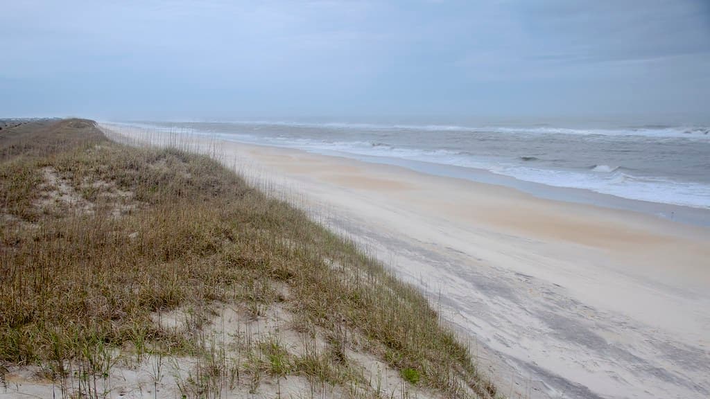
“You'll park on sun-bleached asphalt that gives way to dunes stitched with sea oats, then step onto sand the color of brown sugar. The Atlantic unfurls in metallic greens, and the only soundtrack is surf punctuated by…”
Limited recent visitor reports — live OBI telemetry is your best guide for current conditions.
Salvo sits in the quiet middle of Hatteras Island, a village so low-key that beach access ramps bear numbers instead of branded names. You'll recognize it by the weathered pilings of the old Salvo Day Use Area and the pickup trucks angled toward the waterline, their beds loaded with surf rods and Coleman coolers. Families spread quilts near the dune line while fathers teach sons to read the sloughs where pompano feed.
The beach slopes gently here, and at low tide the exposed sandbars form shallow pools warm enough for toddlers to splash without the punch of breaking waves. Shorebirds work the wrack line in efficient V-formations—willets, sanderlings, the occasional oystercatcher with its traffic-cone beak. You won't find cabana rentals or jet-ski concessions, just miles of sand interrupted only by the occasional beach umbrella or surf caster wading thigh-deep into the green churn.
Credit: FlickrCatch Outer Banks Swells
Credit: FlickrPhotograph Ghost Forests
Consistent sandbars for longboarders
Salt-killed cedars near dune line
Warm sandbars at low tide
Where it is
Salvo Beach
Salvo, North Carolina, USA
35.542200°, -75.472400°
Weather
Loading…
Swell
—
Temp
Warm · Restorative
UV Index
Moderate
Wind
—
Tidal State
Last known
Max Sunlight
—
Ideal Shade
—
May - Sep (Peak)
Jan - Dec (Off-season)
Historical data suggests peak visibility and stable sea temperatures occur during the prime visitation window.
Select a category to load nearby places.
Unlock restaurants, luxury stays and curated maritime experiences within 2km
Salvo Beach generally offers good swimming conditions, though the Atlantic Ocean here can have variable surf and occasional strong currents. There are no lifeguards on duty, so swim at your own risk and stay alert to changing conditions. Check local surf reports and weather forecasts before entering the water. The beach is known for its gradual slope, making it relatively family-friendly, but always supervise children closely. Red flag warnings are posted when conditions are dangerous. The area is part of Cape Hatteras National Seashore, which provides beach safety information at visitor centers.
Salvo Beach is enjoyable year-round, with each season offering different experiences. Summer (June-August) brings warm temperatures in the 80s°F and the warmest ocean water, but also peak crowds. Spring and fall (April-May, September-October) offer pleasant weather in the 60s-70s°F with fewer visitors, ideal for beachcombing and fishing. Winter is quiet and cool, perfect for solitude seekers. Hurricane season runs June through November, with September being peak month. The Outer Banks location means wind is common year-round, which attracts kiteboarders but can affect beach comfort.
Salvo Beach is located on North Carolina's Outer Banks, accessible via NC Highway 12. From the mainland, take US-64 or US-158 east, then follow NC-12 south through Nags Head and past Rodanthe. The village is about 40 miles south of Nags Head. Public beach access areas have small parking lots along Highway 12, including several in Salvo with basic facilities. Parking is free at Cape Hatteras National Seashore access points. Four-wheel-drive vehicles can access certain beach areas with proper permits. Be aware that Highway 12 occasionally closes due to storms or overwash.
Salvo is a small, quiet village with limited commercial development. You'll find a few vacation rental homes and no major hotels directly in Salvo. Nearby Avon (7 miles south) and Rodanthe (8 miles north) offer more dining options, grocery stores, and accommodations. Most visitors rent beach houses for the week. Stock up on groceries and supplies in larger towns like Nags Head before arriving, as options are limited. A convenience store or two operates seasonally in the area. For diverse restaurant choices and full-service amenities, plan to drive to Avon or further to Buxton.
Yes, Salvo Beach is part of Cape Hatteras National Seashore's off-road vehicle (ORV) area. You can drive on designated beach sections with a proper ORV permit, which can be purchased online or at National Park Service stations. A 4-wheel-drive vehicle is required, and you must follow NPS regulations including staying in marked corridors, respecting seasonal closures for wildlife nesting, and carrying required safety equipment. Beach driving is popular among fishermen and families wanting to access remote spots. Check current ORV routes and closures before your trip, as they change seasonally to protect shorebirds and sea turtles.
Photos