
Counting the waves…
Counting the waves…
A refined fusion of water purity, environmental stability, and communal vibrancy for Playa Punta Dungeness Norte.
View MethodologyAnalyzed via live sensors and environmental data.
Wave height, wind, and atmospheric stability.
Live footfall and crowd balance metrics.
Community reviews and curated sentiment.
“You stand on stones that mark the boundary between nations and ecosystems, where Patagonian steppe plunges into the sea and the only witnesses are guanacos watching from hillsides. The beach curves north toward…”
Limited recent visitor reports — live OBI telemetry is your best guide for current conditions.
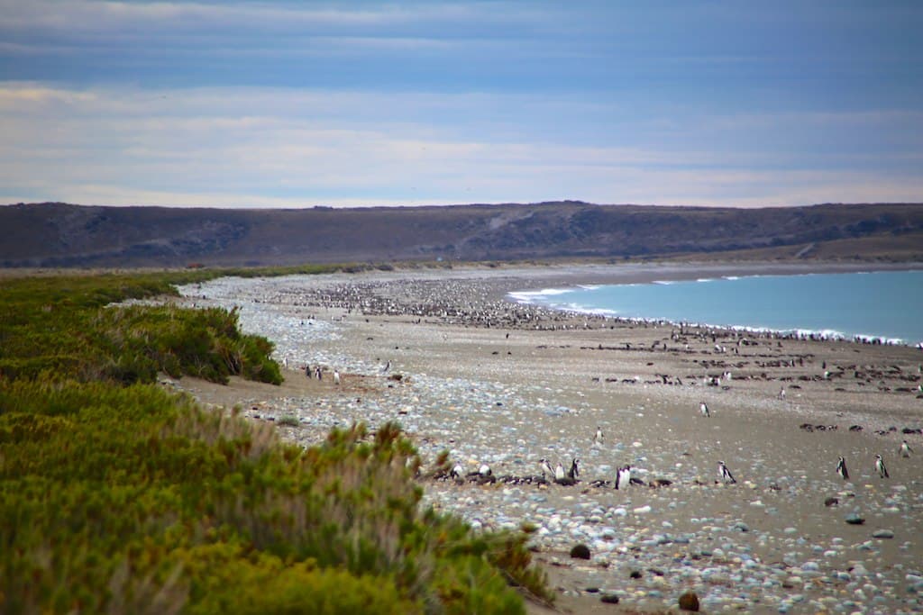
The border fence ends at the tide line, its posts rusted to lace by salt spray, barbed wire trailing into kelp wrack where jurisdiction becomes meaningless. You walk the beach scanning for the boundary marker—a weathered concrete pillar half-buried in shifting pebbles, worn smooth by wind and time. To your north, Argentina. South, the same, but somehow different, the way invisible lines reshape perception even when geology refuses to acknowledge them.
The pebbles here are smaller than at Costa de los Naufragios, sorted by longshore current into graduated bands—gravel nearest the water, fist-sized stones at the storm line, then larger cobbles cemented with dried salt at the vegetation edge. You find beach-polished bricks, probably from some shepherd's vanished shelter, and fragments of green glass worn into organic shapes. A skua glides past at eye level, riding the updraft where wind hits the low cliff behind you. The western sky threatens weather that may or may not arrive; forecasting here is faith-based.
International boundary at shoreline
Chilean mountains across water
Completely empty pebble shore
Prime Visitation
Anytime | Less Crowds
Where it is
Playa Punta Dungeness Norte
Cabo Vírgenes, Santa Cruz, Argentina
-52.379800°, -68.420400°
Weather
Loading…
Swell
—
Temp
Warm · Restorative
UV Index
Moderate
Wind
—
Tidal State
Last known
Max Sunlight
—
Ideal Shade
—
Jan - Dec (Peak)
Mar - Nov (Off-season)
Anytime | Less Crowds
Select a category to load nearby places.
Unlock restaurants, luxury stays and curated maritime experiences within 2km
Swimming is not advisable at this beach due to frigid water temperatures, strong currents from the Strait of Magellan, and unpredictable coastal conditions. Water rarely exceeds 10°C (50°F) even in summer. The exposed pebble beach faces powerful winds and waves that can surge unexpectedly. The remote location means emergency services are hours away. This beach is ideal for coastal walks, birdwatching, and landscape photography rather than water activities. Always maintain awareness of tide times and weather conditions, as both can change rapidly in this extreme environment.
The beach is accessible year-round, though summer months (December-February) offer the most comfortable conditions with temperatures around 10-15°C (50-59°F) and extended daylight. Spring (September-November) brings migrating birds and wildflowers, while autumn (March-May) offers stunning light for photography and fewer visitors. Winter visits require preparation for harsh conditions with freezing temperatures and fierce winds. Regardless of season, the area sees minimal crowds due to its remote location. Plan around weather forecasts and always prepare for sudden changes in Patagonian conditions.
The beach is located near Cabo Vírgenes, approximately 130 km south of Río Gallegos via Route 1. The journey requires a vehicle, preferably with 4WD capability, as roads are largely unpaved and conditions vary. Travel time is roughly 2 hours from Río Gallegos. From the Cabo Vírgenes area, reaching the beach involves walking along coastal paths from the main road or lighthouse area. No public transportation serves this region. Rental cars from Río Gallegos or organized tours are the practical options. Check road conditions before departure.
There are no facilities directly at or near this beach. Río Gallegos, approximately 130 km north, is the nearest town with full services including hotels, restaurants, supermarkets, and fuel stations. The Cabo Vírgenes lighthouse area has limited visitor facilities but no accommodations or food services. Visitors should bring all necessary supplies including food, water, and emergency provisions. Day trips from Río Gallegos are most practical. Pack extra layers, windproof clothing, and more supplies than anticipated, as weather conditions can delay return travel unexpectedly.
This northern sector beach marks the transition zone approaching Cabo Vírgenes from Río Gallegos, offering a quieter alternative to the main lighthouse area. Its position provides unique perspectives of the Magellan Strait entrance and border coast with Chile. The beach receives fewer visitors than the main Cabo Vírgenes attractions, ensuring exceptional solitude. Sunset views can be spectacular when weather permits, with dramatic skies over the strait. The pebble beach and windswept landscape exemplify raw Patagonian coastal environments. Proximity to the Argentine-Chilean border adds geographical interest.