
Counting the waves…
Counting the waves…
A refined fusion of water purity, environmental stability, and communal vibrancy for Playa Sur Cabo Vírgenes.
View MethodologyAnalyzed via live sensors and environmental data.
Wave height, wind, and atmospheric stability.
Live footfall and crowd balance metrics.
Community reviews and curated sentiment.
“You stand at the southernmost edge of the Argentine mainland, where rounded stones shift beneath your boots and kelp ribbons tangle in the surf. The lighthouse beam sweeps overhead as frigid air carries the salt-sting…”
Limited recent visitor reports — live OBI telemetry is your best guide for current conditions.
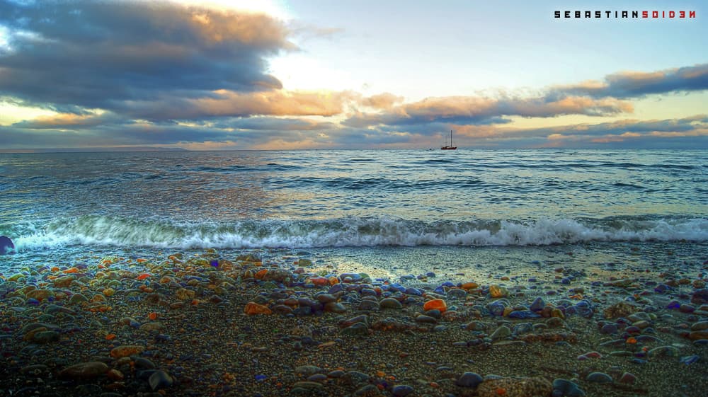
Your first step onto Playa Sur Cabo Vírgenes sends a rattling chorus through millions of wave-polished stones. The beach unfolds in a gradual curve toward the Strait of Magellan, each incoming wave rearranging the shoreline with a sound like marbles spilling across tile. Guanacos graze the tussock grass above the high-tide line, indifferent to the wind that presses your jacket flat against your ribs.
The southern sky here holds light differently than anywhere else you've traveled. Late afternoon sun slants low across the water, turning the foam gold and casting long shadows from every driftwood log. Magellanic penguins waddle past during nesting season, their calls mingling with the perpetual thunder of breakers. You kneel to examine the pebbles—granite, basalt, quartz—each one a refugee from the Andes, tumbled smooth across geological time.
Long-tail boats moored in clear water
Follow the pebble shore south
Capture the historic beacon frame
Watch nesting Magellanic colonies nearby
Prime Visitation
Anytime | Less Crowds
Where it is
Playa Sur Cabo Vírgenes
Cabo Vírgenes, Santa Cruz, Argentina
-52.352500°, -68.382200°
Weather
Loading…
Swell
—
Temp
Warm · Restorative
UV Index
Moderate
Wind
—
Tidal State
Last known
Max Sunlight
—
Ideal Shade
—
Jan - Dec (Peak)
Mar - Nov (Off-season)
Anytime | Less Crowds
Select a category to load nearby places.
Unlock restaurants, luxury stays and curated maritime experiences within 2km
Swimming is strongly discouraged at Playa Sur Cabo Vírgenes due to dangerously cold water temperatures, powerful currents, and the beach's exposed position facing the Strait of Magellan. The pebble beach and proximity to the strait entrance create particularly challenging conditions with unpredictable waves and undertows. This beach is best appreciated for coastal walks, photography, and observing the dramatic meeting point of Atlantic waters and the Magellan Strait. The extremely remote location and absence of emergency services make any water activities especially risky. Visitors should exercise caution even when walking near the water's edge.
Visit during the southern summer months (December through February) for relatively milder weather and longest daylight hours, though this beach is accessible year-round. The sunset designation makes late afternoon visits particularly rewarding, especially during summer when the sun sets over the Strait of Magellan creating spectacular lighting. Spring (November) and autumn (March) offer good conditions with fewer visitors than peak summer. All seasons bring strong winds, so windproof clothing is essential. Winter visits appeal to adventurous travelers seeking dramatic storm-watching opportunities. The beach remains uncrowded throughout the year, allowing flexible timing.
Access begins with the 130-kilometer drive south from Río Gallegos via Route 1, taking approximately 2-3 hours on mostly gravel roads. From the Cabo Vírgenes lighthouse area, reaching Playa Sur involves navigating toward the southern coastal stretches facing the Strait of Magellan. A vehicle with good clearance helps, though roads vary by season and weather. Some sections may require walking from parking areas. Rental cars from Río Gallegos provide independence; organized tours from the city typically focus on the lighthouse and may not include this southern beach sector. GPS coordinates and regional maps assist navigation in this remote area.
No facilities, restaurants, or lodging exist at this beach or anywhere nearby. Río Gallegos, roughly 130 kilometers north, is the essential base offering hotels, hostels, restaurants featuring Patagonian lamb and seafood, and supermarkets for provisioning. Bring complete supplies including meals, drinking water, snacks, and emergency food before leaving the city. Ensure your vehicle has sufficient fuel for the entire round trip. A few estancias in the broader region offer accommodation but require advance reservation and remain far from the beach itself. Plan this as a day trip, carrying everything needed for several hours in a remote environment.
Playa Sur's southern position creates unique views toward the Strait of Magellan, offering perspectives distinct from northern or central beach sectors. Its orientation makes it exceptional for sunset photography as the sun descends over the strait. The southern stretch provides different geological features and potentially varied wildlife compared to Atlantic-facing beaches. Being off the standard tourist circuit from the lighthouse to the penguin colony, it offers remarkable solitude. The beach marks a significant geographical point where the South American Atlantic coast transitions to the Magellan entrance, giving it special character. This remoteness preserves its pristine, undiscovered quality.
Photos